

We support governments, engineers, and infrastructure planners by delivering reliable aerial, marine, and subsurface mapping solutions that help reduce risk, improve efficiency, and enable confident project planning.
LSYSTEMS partners with trusted distributors to ensure our products and solutions reach customers efficiently across different regions. Our distribution network is designed to provide reliable access, fast delivery, and consistent service quality. Click the button below to visit our official distribution partner and explore availability in your area.
Our experienced team utilizes advanced surveying technologies and modern geospatial methods to collect accurate and dependable spatial data.
This ensures every project is delivered with precision and aligned to your specific requirements.
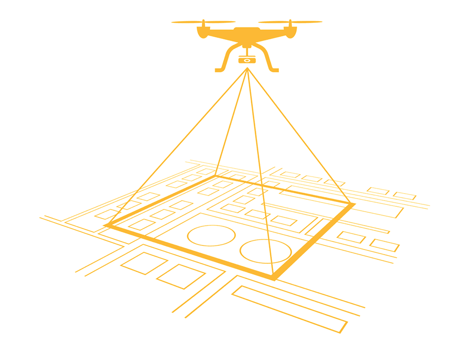
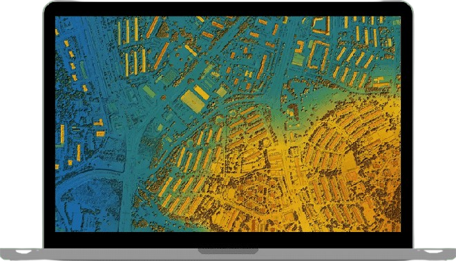
LSYSTEMS delivers high-precision aerial mapping using advanced UAV drone platforms and LiDAR technology.
Read More
LSYSTEMS offers advanced 3D scanning and digital twin services to create highly accurate digital representations of physical assets and environments.
Read More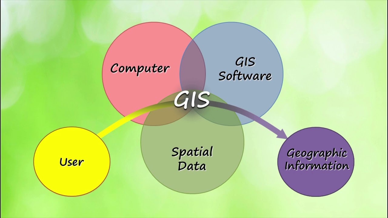
LSYSTEMS provides comprehensive Geographic Information System (GIS) and spatial intelligence solutions that help organizations manage, analyze, and visualize geospatial data.
Read More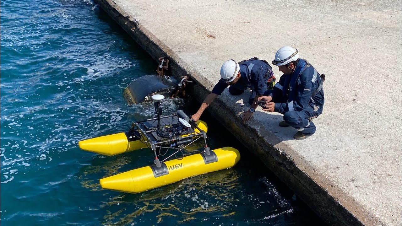
LSYSTEMS provides specialized bathymetric and marine surveying services for coastal, river, and marine environments.
Read More
LSYSTEMS offers professional land and cadastral surveying services to support property development, land registration, and boundary identification.
Read More
LSYSTEMS delivers professional engineering and infrastructure surveying services that support construction, transport, and large-scale development projects.
Read More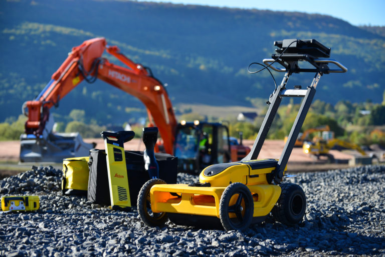
LSYSTEMS provides advanced utility detection and subsurface mapping services to identify underground infrastructure before construction or excavation begins.
Read More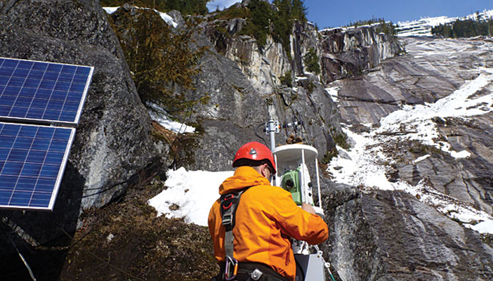
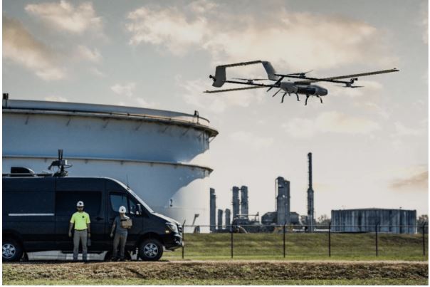
LSYSTEMS supports environmental management and infrastructure monitoring through advanced surveying and geospatial technologies.
Read More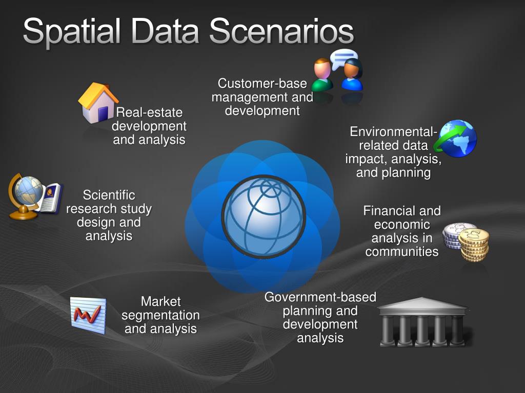
LSYSTEMS operates a spatial data marketplace where organizations can access and license valuable geospatial datasets.
Read More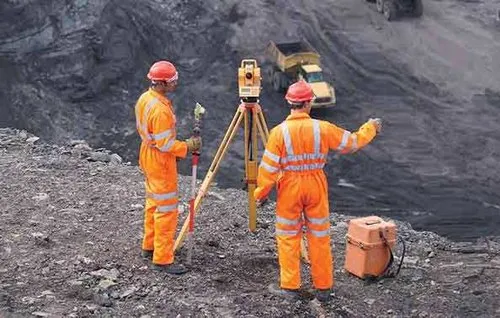
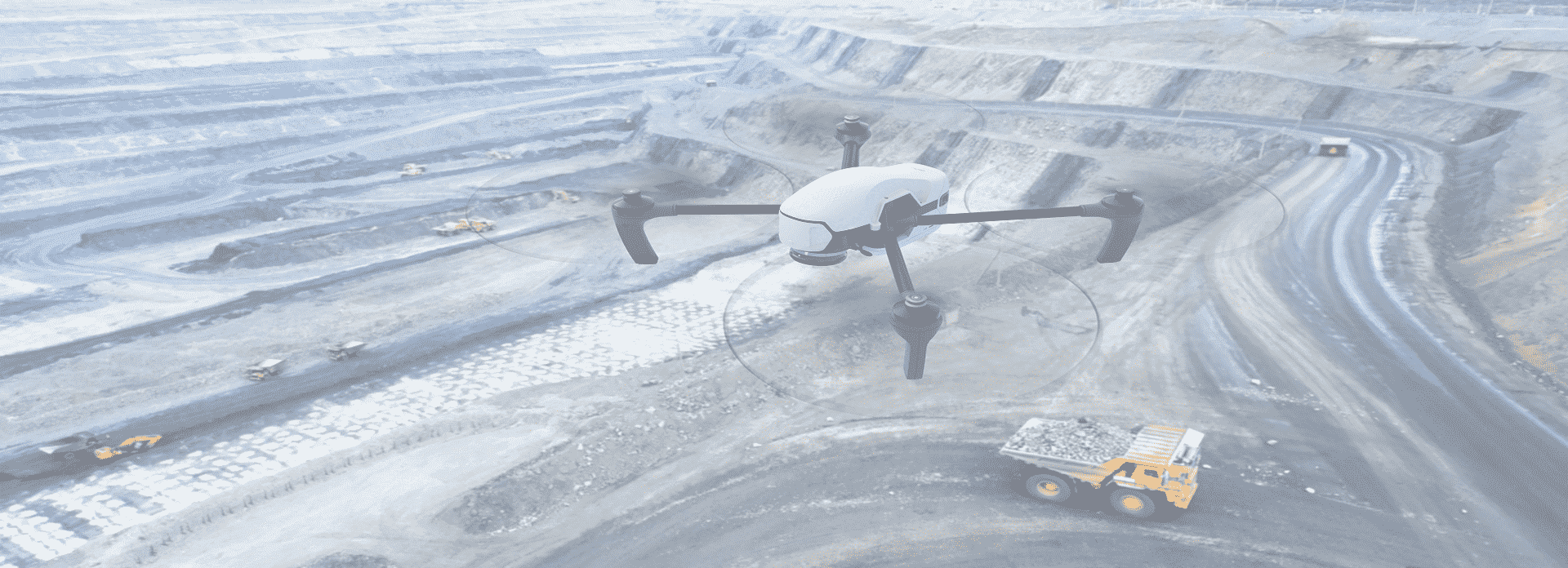
LSYSTEMS provides advanced mining survey solutions designed to support safe, efficient, and high-productivity mining operations.
Read More
Our Aerial Cleaning System is a state-of-the-art solution designed to clean hard-to-reach areas efficiently and safely using advanced drone technology.
Read More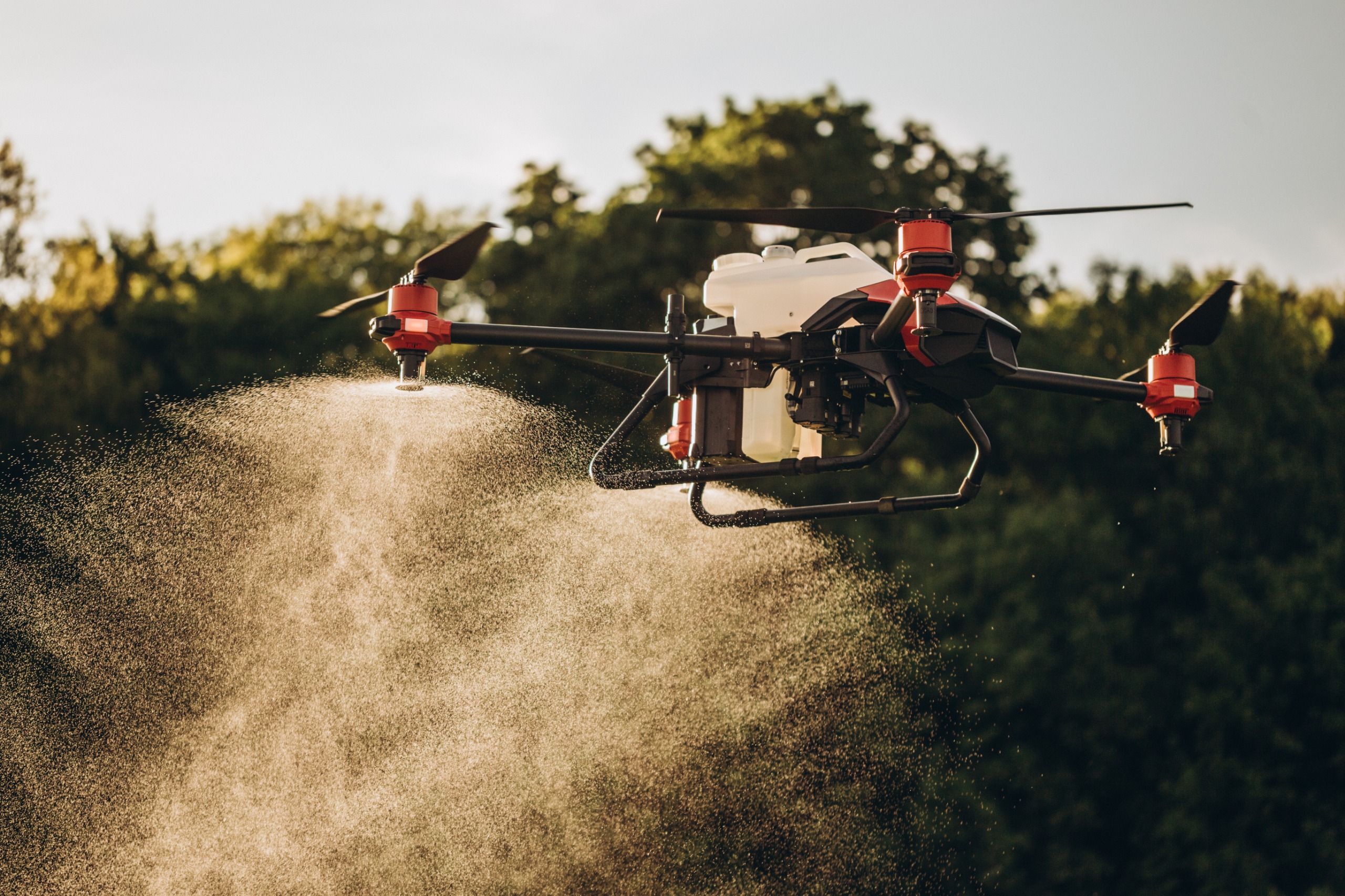
LSYSTEMS provides advanced drone-based agriculture spraying solutions designed to improve efficiency, reduce waste, and enhance crop productivity across diverse terrain.
Read More
This service complements helicopter or road logistics, cuts costs and response times, and improves safety by minimising ground travel in high-risk or weather-affected regions.
Read MoreLSYSTEMS integrates aerial LiDAR, drone imagery, utility investigation data, and hydrographic surveys to deliver a complete understanding of both natural and built environments. Our solutions provide designers, engineers, and project teams with accurate spatial insights to support better planning and execution

LSYSTEMS provides the spatial intelligence and data-driven insights needed to support confident project planning. Avoid unnecessary risks caused by outdated or inaccurate data by using precise, technology-driven survey solutions.
Contact our team today to discuss your project requirements.